
See every road and pathway user
— automatically.
Cities today move faster than ever. Cytrix was built to keep up.
Cities today move faster than ever. Streets are no longer shaped by cars alone; they are alive with scooters, e-bikes, cargo cycles, delivery bots, and new forms of lightweight mobility that redefine how people navigate urban space.
But while the world shifts, most city infrastructure still sees movement through an outdated lens — counting too little, knowing too little, and reacting too slowly.
Cytrix was created to change that.
(non-intrusive tech.)
Every user,
automatically classified
Cytrix doesn't just count vehicles. It distinguishes between 20+ classes of road and pathway user — cars, HGVs, buses, cyclists, e-scooters, pedestrians and more — so you get a true picture of everyone using the space, not just the traffic.
- 20+ classes of road and pathway user, out of the box
- Distinguishes vehicles, cyclists, pedestrians and micromobility
- Accuracy that holds up in low light and poor weather
- New classes added as your monitoring needs evolve
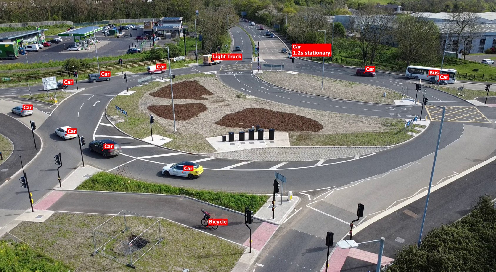
See the near-misses,
not just the collisions
Most safety data only starts once something has already gone wrong. Cytrix flags near-miss interactions between road and pathway users as they happen — a close pass, a sudden swerve, a pedestrian stepping back from a kerb — giving you evidence long before a collision does.
- Automatic near-miss detection between any two user classes
- Incident clips saved automatically for review
- Trend reporting on near-miss hotspots over time
- Evidence you can use for safety cases, not just estimates
Processed locally,
right at the roadside
Cytrix runs its AI models on-site, not in the cloud. That means faster results, far less bandwidth needed, and less raw footage ever leaving the camera — a meaningfully different privacy and reliability position to camera systems that stream everything back to a data centre.
- On-device edge AI processing at every Cytrix site
- Low-bandwidth operation, ideal for remote or rural sites
- Keeps working through connectivity drop-outs
- Minimises raw footage transmitted or stored off-site

Live video, stills and analytics,
from anywhere
Every Cytrix site is reachable from one dashboard. Check the live camera feed, pull a still image, or dig into the analytics — whether you're planning a scheme, investigating an incident, or just checking in.

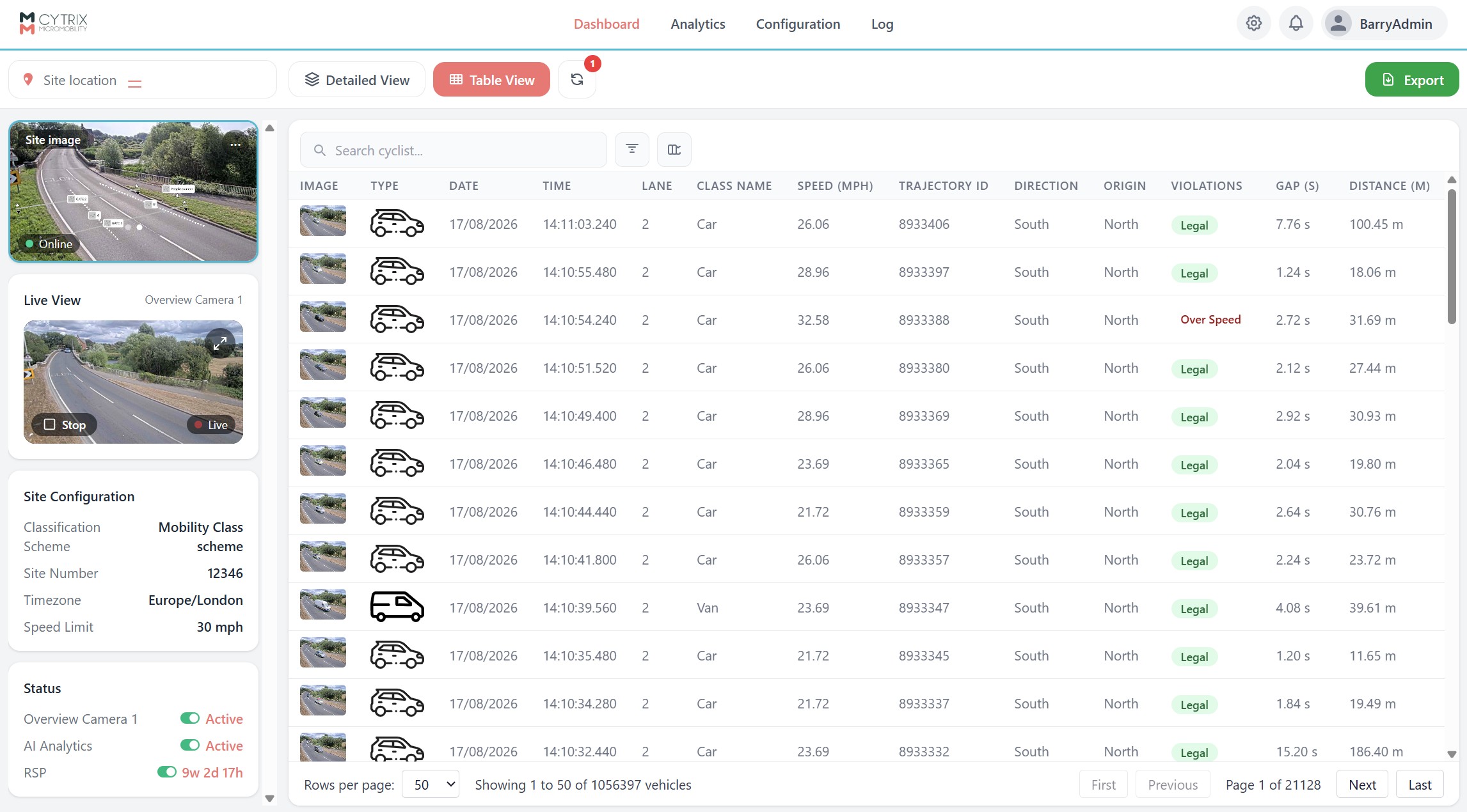
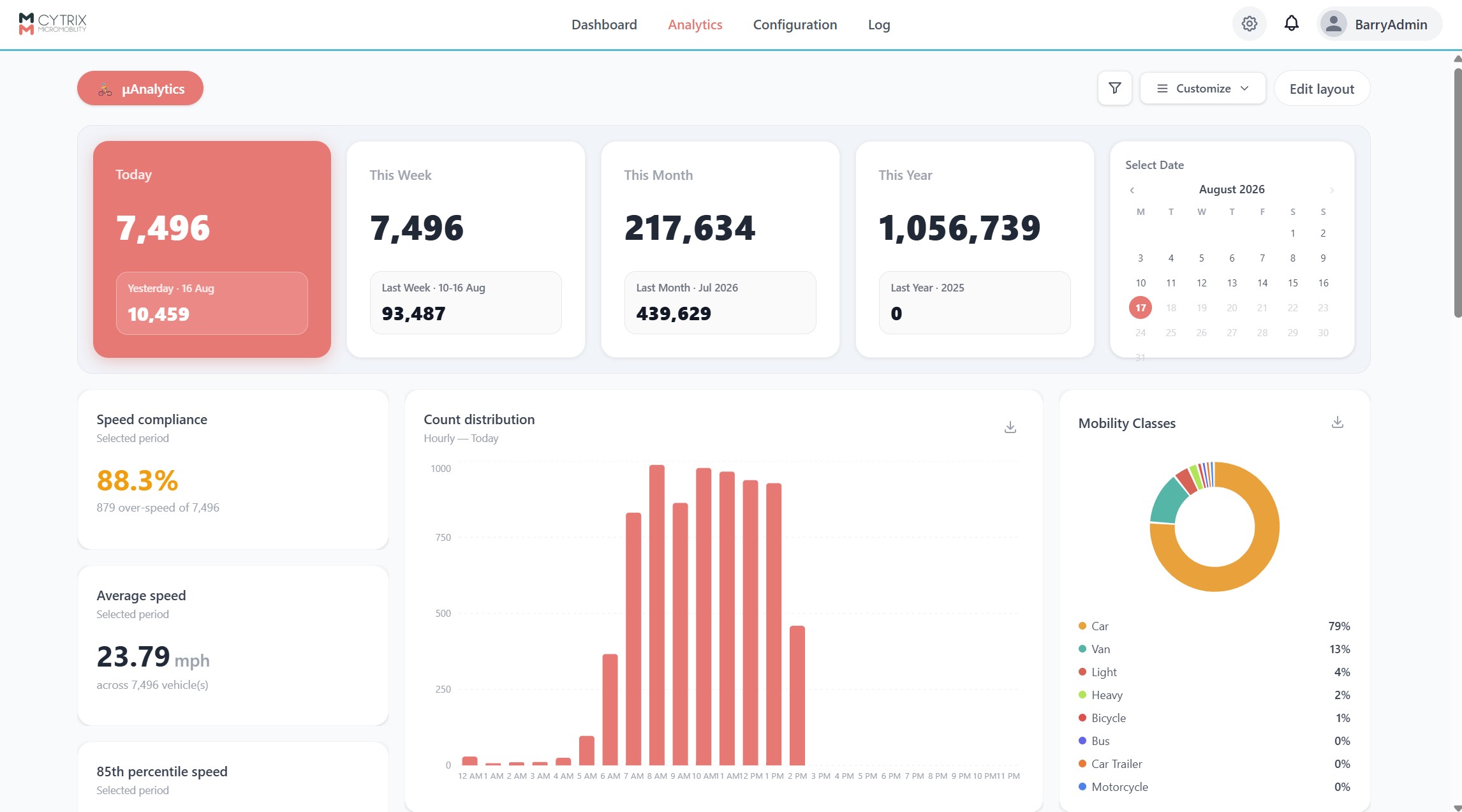
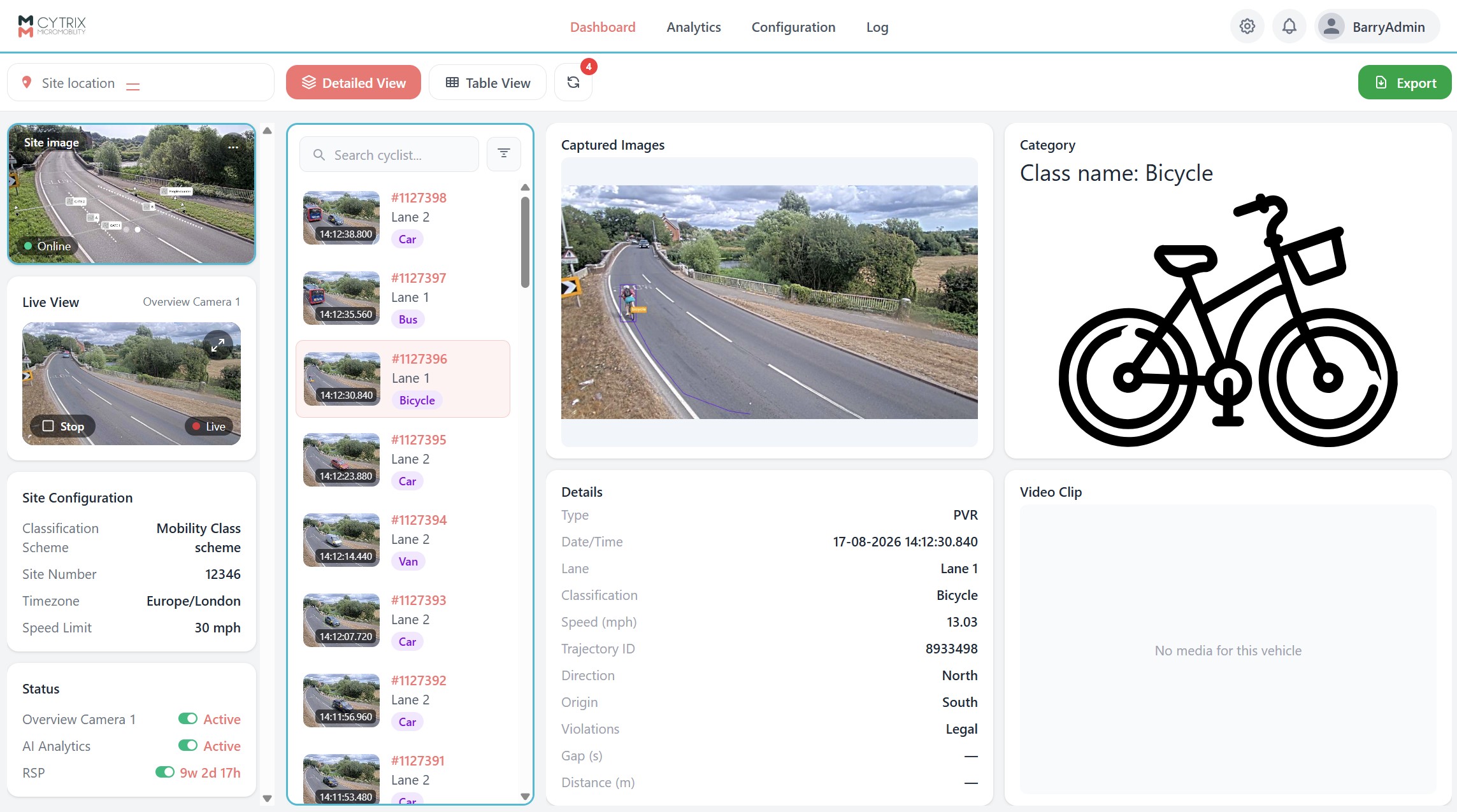
- Live video and still-image access from any Cytrix site
- Analytics dashboard updated in real time
- Historic playback for any recorded incident
- Exportable reports for planning and consultation
Privacy protection,
built in from the start
Patented automatic anonymisation obscures faces, licence plates, selected elements, or entire images. Local edge processing analyses image data on-site rather than transmitting it to the cloud, supporting privacy-by-design and compliance with GDPR.
- Patented automatic anonymisation of faces & licence plates
- Choose to obscure specific elements or entire images
- Image data analysed on-site, never transmitted to the cloud
- Privacy-by-design, fully GDPR compliant

Your data,
on your own, recognised, ITS data host
Cytrix is vendor-agnostic — view your data locally at the roadside, or have it delivered seamlessly to your existing ITS data host. There's no need to adopt a new platform just to get the insight Cytrix provides.
- Vendor-agnostic delivery to your existing ITS data host
- Run your traffic recognised data reports in the Drakewell platform
- No need to adopt a new platform for your team
- Managed SIM card connectivity included

Who uses Cytrix
For the first time, cities gain a true picture of how modern mobility really behaves. And operators gain the data needed to plan networks, reduce conflict, optimise infrastructure, and build safer, more responsive streets.
Cycling & walking schemes
Real usage data for active travel infrastructure, before and after a scheme goes in.
Vision Zero & safety audits
Near-miss data that supports safety cases, not just post-incident collision records.
Planning & consultation teams
Evidence-based classification data to support planning applications and public consultation.
Highways & local authorities
One camera covering counting, classification and incident monitoring at a single site.
Want the full technical detail?
Download the spec sheet and data sheet — enter your email and the download starts straight away.
Ready to see Cytrix in action?
Book a walkthrough with our engineering team and see what Cytrix picks up on your own roads and pathways.